Reading the Sabi Sands map for a seamless luxury safari
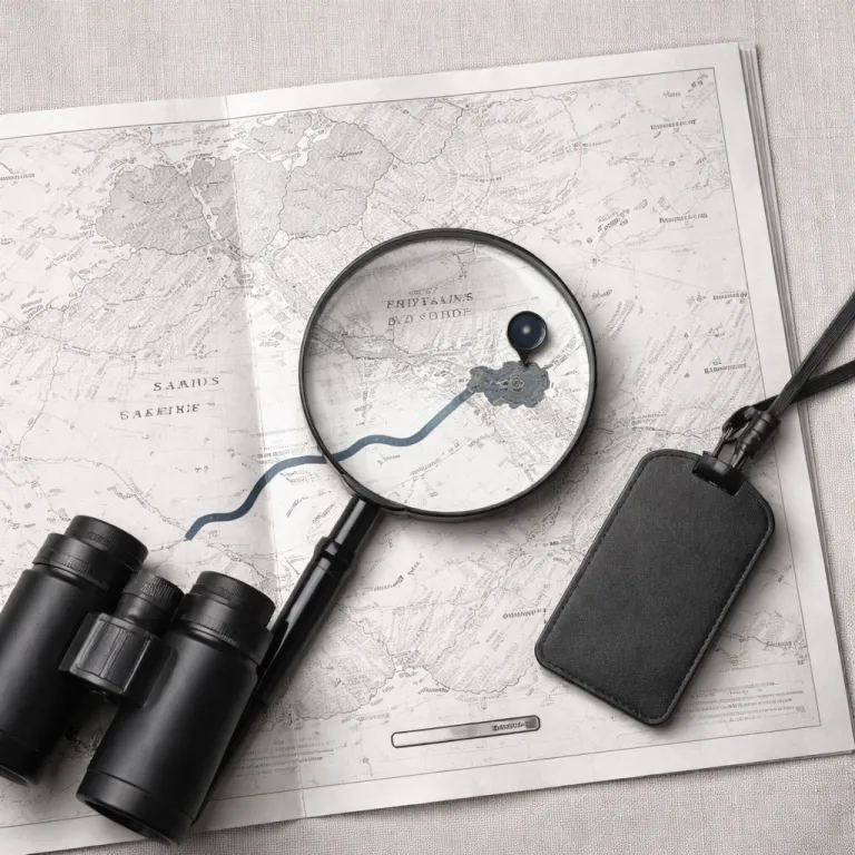
The updated Sabi Sands map is now an essential planning tool. It shows how the private game reserve wraps along the western edge of Kruger National Park, clarifying where each lodge sits in relation to the famous wilderness. When you understand the map layout, every transfer, game drive, and lodge arrival feels calmer and more intentional.
On this refined map, each entry point is clearly marked, from Shaws Gate in the south to Newington Gate and Gowrie Gate further north. These access gates define how you move between Kruger, the private reserve, and your chosen lodges, especially when you arrive from Skukuza Airport or Kruger Mpumalanga International Airport. Knowing which gate aligns with your lodge location saves time and reduces the person fee surprises sometimes linked to different routes.
The Sabi Sands Game Reserve covers more than sixty thousand hectares, so scale matters when reading any map. Distances between lodges, sand river crossings, and game drive areas can be longer than they appear, particularly if you are used to compact European nature reserves. A precise Sabi Sands map helps you understand how the reserve borders Kruger National Park while remaining a separate, privately managed game reserve with its own access rules.
For luxury and premium hotel booking in South Africa, this level of clarity is invaluable. When you compare lodges, you can see which ones sit close to the sand river, which lie near the Kruger gate network, and which are tucked deeper into the African bush. That context lets you match your safari expectations with the exact corner of Sabi Sands that best suits your travel style.
Choosing the right access gate and timing your arrival
Understanding the Sabi Sands map also means understanding the gates that frame your journey. Shaws Gate, Newington Gate, and Gowrie Gate each serve different sectors of the reserve, and your lodge confirmation usually specifies the correct entry. When you plan your travel time from Kruger Mpumalanga International Airport or Skukuza Airport, matching the right gate to the right lodge is critical.
Many guests combine a stay in Sabi Sands with nights in Cape Town or other premium hotels across South Africa. When you book a luxury suite in the city, then connect to a safari lodge, the map helps you visualise how your urban and wilderness experiences fit together. For inspiration on elevated city stays, you can review this guide to the finest premium suites in Cape Town before planning your onward safari.
Gate operating hours are strict, and the person fee for late arrivals or special arrangements can be significant. By reading the Sabi Sands map alongside your flight schedule, you can decide whether to route via Kruger Mpumalanga or Skukuza Airport, or to overnight near Kruger National Park before entering the game reserve. This approach respects both the sand nature environment and the safety protocols that protect wildlife and guests.
Some travellers underestimate driving times between the national park, the reserve, and the main access gates. The map shows that even short distances on paper can involve slower gravel roads, wildlife crossings, and occasional stops at Kruger gate checkpoints. Planning conservatively allows you to arrive at your lodge relaxed, ready for your first safari drive rather than rushing through the African dusk.
Positioning of lodges, rivers, and prime game viewing areas
For many guests, the most important layer on any Sabi Sands map is the position of the lodges. Each lodge sits within a specific sector of the game reserve, often near a waterhole, river, or open sand clearing that attracts wildlife. When you compare lodges, the map helps you understand how their locations influence game viewing, privacy, and access to iconic landscapes.
The sand river and its tributaries run like lifelines through Sabi Sands, shaping both the ecosystem and the safari experience. Properties such as lion sands and other riverside lodges benefit from constant animal movement along the water, which you can see clearly when you study the map. In drier months, these river corridors become even more important, concentrating game and making each drive from your lodge feel intensely rewarding.
Because Sabi Sands shares an unfenced boundary with Kruger National Park, animals move freely between the two areas. The map highlights this invisible line, reminding you that a leopard seen near your lodge today might roam into Kruger park tomorrow. This fluid movement is one reason the reserve is renowned for close big cat sightings and why the sands game environment is so prized among photographers.
When booking through a luxury and premium hotel platform, use the map to balance seclusion with convenience. Some lodges sit close to access gates like Newington Gate or Gowrie Gate, ideal for shorter transfers and families. Others lie deeper within the sand nature reserve, where the sense of remoteness is stronger, and the night sky over this part of South Africa feels almost untouched.
Integrating flights, transfers, and fees into your booking strategy
A thoughtful reading of the Sabi Sands map transforms how you plan flights and transfers. The proximity of Skukuza Airport and Kruger Mpumalanga International Airport to different gates influences not only travel time but also overall comfort. When you align your arrival airport with the nearest entry to your chosen lodge, your journey into the game reserve becomes smoother and more predictable.
Many luxury travellers underestimate the impact of transfer logistics on their overall safari experience. A map that clearly shows the distance between each airport, each gate, and each lodge allows you to weigh the cost of a short charter flight against a longer road transfer. This is especially relevant when you consider the person fee structures that sometimes apply at Kruger gate points or private access gates into Sabi Sands.
Within the broader context of African travel, Sabi Sands stands out for its combination of exclusivity and accessibility. The reserve sits in the Mpumalanga region of South Africa, yet feels worlds away from city life once you pass through Shaws Gate or Newington Gate. By using an accurate map, you can coordinate your time in the game reserve with stays at premium hotels elsewhere in the country, creating a coherent itinerary rather than a series of disconnected bookings.
For deeper planning around luxury stays, many travellers consult specialised guides to premium hotel experiences in South Africa. Resources such as this overview of premium hotel stays online in South Africa can complement your Sabi Sands map reading. When you combine that strategic insight with clear visuals of the game reserve, you can allocate time and budget with far greater confidence.
How the updated Sabi Sands map supports safety and conservation
The latest Sabi Sands map is more than a navigation aid for guests. It reflects extensive satellite imagery, on site surveys, and GIS mapping that help lodge teams manage roads, water points, and sensitive sand nature habitats. By following the routes indicated on the map, guides reduce off track driving, which protects vegetation and minimises disturbance to wildlife.
Accurate mapping also plays a role in guest safety during every safari activity. When a vehicle leaves the lodge for an afternoon game drive, the guide knows exactly which roads lead back to the nearest gate, airstrip, or neighbouring property. In the unlikely event of an emergency, this shared understanding of the game reserve layout allows rapid coordination between lodges, rangers, and external responders.
The map further clarifies the boundary between Sabi Sands and Kruger National Park, which is crucial for anti poaching patrols and ecological monitoring. Because animals move freely between the national park and the private reserve, conservation teams rely on precise data about water sources, sand river channels, and vegetation zones. This information supports decisions about road closures, controlled burns, and other measures that keep the African ecosystem resilient.
Guests contribute to this effort when they respect the guidelines printed on the map and briefed at each lodge. Staying on designated roads, observing speed limits, and honouring gate times all help maintain the integrity of the sands game environment. In turn, this responsible behaviour ensures that future travellers can enjoy the same intimate encounters with wildlife that make Sabi Sands one of South Africa’s most celebrated safari destinations.
Using the Sabi Sands map to personalise your luxury safari stay
For travellers booking through a luxury and premium hotel platform, the Sabi Sands map becomes a tool for personalisation. If you value quick access to Kruger park for a day trip, you might choose a lodge near Shaws Gate or another Kruger gate that connects easily to the national park. If you prefer deep immersion in the game reserve, you may focus on lodges further from the main entry points, where the African night feels especially quiet.
The map also helps you align your stay with specific interests, from birding to photography or family travel. Families might appreciate lodges closer to access gates and airstrips, reducing transfer time for younger guests and simplifying logistics around person fee payments. Photographers, by contrast, may prioritise lodges near the sand river or open plains, where the sands game landscape offers varied backdrops throughout the day.
When you compare options, pay attention to how each lodge describes its traversing rights within the game reserve. Some properties share large areas of Sabi Sands, giving guides flexibility to follow wildlife across different habitats, while others focus on more compact zones. The map shows how these areas relate to Kruger National Park, nearby sand nature features, and the broader South Africa safari circuit.
Ultimately, a well read Sabi Sands map allows you to move beyond generic safari packages. You can decide how much time to spend in the reserve versus other regions, which access gates best suit your route, and how your chosen lodge fits into the wider African journey. By grounding every decision in clear geography, you elevate both the comfort and meaning of your luxury safari stay.
Key statistics for planning your Sabi Sands stay
- The Sabi Sands Game Reserve covers approximately 62 308 hectares of protected land.
- The reserve hosts at least six established luxury lodges within its boundaries.
- Multiple access gates, including Shaws Gate, Newington Gate, and Gowrie Gate, connect the reserve to surrounding roads.
- Sabi Sands shares an unfenced boundary with the larger Kruger National Park ecosystem.
Essential questions about accessing Sabi Sands
How do I access Sabi Sands?
How do I access Sabi Sands? Via Shaw's Gate, Newington Gate, or Gowrie Gate.
Are there direct flights to Sabi Sands?
Are there direct flights to Sabi Sands? Yes, to nearby airstrips from major cities.
What wildlife can I see in Sabi Sands?
What wildlife can I see in Sabi Sands? Big Five, especially leopards.
